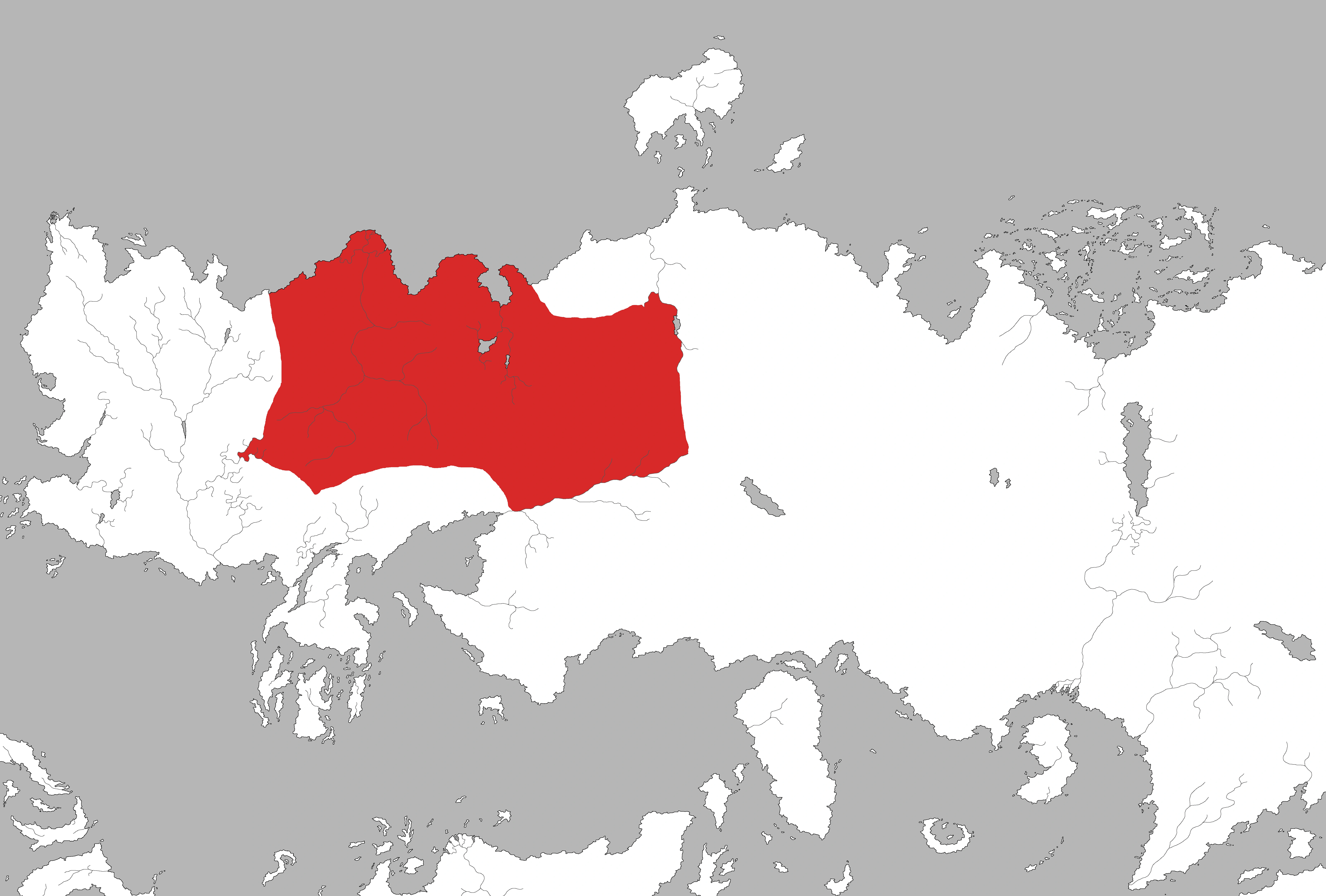
A map showing the approximate borders of the Dothraki Sea on the continent of Essos. Note that the Dothraki range far beyond the edge of the sea and have no respect for national boundaries.
The Dothraki Sea is a region on the continent of Essos, thousands of miles to the east of Westeros. It is located in the continental interior, east of the Free Cities, and is a vast landscape of steppes and plains covered in low green grass which makes it look like a sea from afar. It is named for the Dothraki people who inhabit it, horse-mounted warriors who migrate across the plains in large hordes (each of which may contain thousands of riders) to plunder neighboring lands. Vaes Dothrak, the only city of the Dothraki and central hub of their society, lies on the northeastern edge of the Dothraki sea.
The Dothraki Sea lies north of Lhazar, Slaver's Bay, and the forbidding Red Waste, which even the Dothraki fear to cross. The southern border is loosely marked by the Skahazadhan river. The Red Waste protects the city of Qarth from Dothraki attack. The Dothraki sea stretches almost all the way to the Jade Sea, but stops short due to intervening mountains and forests. However, the Dothraki still occasionally raid the rich cities of the western Jade Sea for treasure and slaves. The Dothraki Sea borders the Forest of Qohor to the west, separating it from the Free Cities. However the forest does not present a significant obstacle to their hordes, which frequently threaten the Free Cities with raids or to exact tribute..[1]
In the books
In the A Song of Ice and Fire novels the Dothraki sea is east of the Free Cities, north of Lhazar and Slaver's Bay and north-west of the Red Waste and the Jade Sea. The Dothraki raid surrounding lands from the "sea" of grass plains, which is unimaginably vast.
References
See also
Template:Essos